Behind the Scenes: Creating Large-Scale 3D Terrain Simulations for Military Use
- Geniuscrate

- Jul 13, 2025
- 3 min read
Updated: Aug 11, 2025
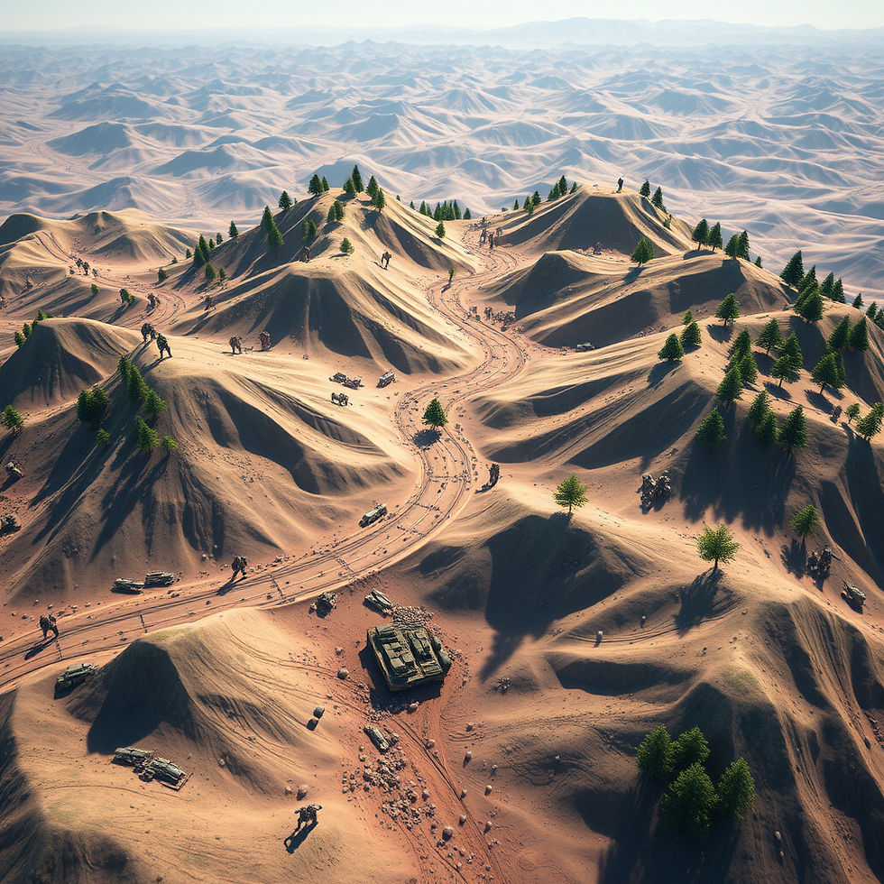
From tactical training and mission planning to virtual simulation and AI testing, 3D terrain environments have become a critical component of military readiness. But creating these vast digital landscapes is no small feat; it requires a balance of accuracy, scale, performance, and detail.
At GeniusCrate, we specialize in building large-scale, simulation-ready terrains for defense and aerospace applications. These environments aren't just visually striking, but they’re also engineered for real-time use in mission rehearsal platforms, combat training simulations, and immersive VR exercises.
Here’s a look behind the scenes at how we design and deliver high-impact 3D terrains for military simulation use.
Step 1: Define the Mission Parameters
Every military terrain project starts with a clear understanding of its strategic application. Is it for:
Infantry training?
Vehicle simulation?
Flight navigation or UAV testing?
AI-based pathfinding and behavior training?
At GeniusCrate, we work closely with defense contractors, developers, and simulation teams to tailor the scope and scale of the terrain to match the operational goals. This ensures we prioritize the right topographic features, structures, and points of interest.
Step 2: Acquire and Analyze Geo-Referenced Data
Authenticity is critical. Depending on the project's classification and access, we may use:
DEM (Digital Elevation Models)
Satellite imagery and aerial scans
GIS and topographic databases
On-ground references and mission specs
This data allows us to recreate real-world terrains or build fictional environments with the same level of geographical realism. Every valley, elevation, and ridgeline has a tactical purpose, and we make sure it’s modeled with precision.
Step 3: Sculpt and Optimize Terrain Geometry
Once reference data is processed, we begin building the terrain using tools like:
World Machine
Gaea
Blender
Unreal Engine’s landscape tools
But realism alone isn’t enough because performance is key. Our modeling team carefully manages:
Polygon count and LOD transitions
Tiling and modular design for scalability
Collision zones and AI navigation meshes
Real-time streaming of distant terrain chunks
This ensures our terrains run smoothly across platforms, whether it's a VR simulator or a high-fidelity CAVE environment.
Step 4: Add Strategic and Environmental Detail
Military terrains aren’t just empty landscapes, but they also require interactive and scenario-relevant features, including:
Structures (bunkers, hangars, outposts, airstrips)
Natural elements (rivers, forests, deserts, mountains)
Road networks, railways, and infrastructure
Weather states and day/night cycles
Our team builds these elements to match the scale, visibility, and interaction logic required by your simulation software.
At GeniusCrate, we ensure every prop, texture, and environmental layer is optimized for Unreal Engine, Unity, or custom simulation platforms used in defense.
Step 5: Test and Calibrate for Simulation Scenarios
A terrain isn’t complete until it’s tested under real conditions. We collaborate with developers and integrators to check:
AI behavior (can bots navigate naturally?)
Physics accuracy (vehicle handling, slopes, collisions)
Streaming performance and memory usage
UX factors like visibility, orientation, and user interaction
We also support scenario-based iterations, where terrain is modified to simulate specific events like:
Ambush setups
Tactical movements
Aerial strikes
Evacuation routes
This flexibility makes GeniusCrate terrains not just detailed, but mission-ready as well.
Why Military Simulations Demand Expert 3D Terrain Design
Unlike entertainment games, military simulations require:
Real-world scale and orientation
Zero tolerance for visual or navigational inaccuracies
Stability across devices and sessions
Accurate terrain features for tactical relevance
That’s why leading simulation teams trust GeniusCrate to build terrain environments that serve both visual and strategic functions, and hold up under the most demanding conditions.
GeniusCrate: Your Partner for 3D Military-Grade Terrain Simulations
Whether you're training ground troops, simulating unmanned systems, or developing VR scenarios for decision-making drills, we provide:
Custom-built 3D terrains based on real data
Optimized performance for defense simulation platforms
Support for Unreal Engine, Unity, and proprietary systems
Real-time testing and calibration for mission success
Let’s build terrain that trains soldiers, tests systems, and supports national security goals.


Comments